
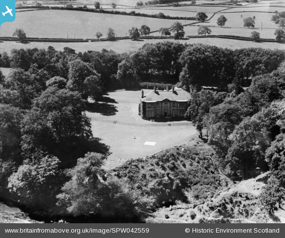
SPW042559 SCOTLAND (1933). The Holmes, St Boswells, Scottish Borders, 1933. An oblique aerial photograph taken facing west.
© Copyright OpenStreetMap contributors and licensed by the OpenStreetMap Foundation. 2026. Cartography is licensed as CC BY-SA.
Nearby Images (2)
SPW042558

SPW042559

Details
| Title | [SPW042559] The Holmes, St Boswells, Scottish Borders, 1933. An oblique aerial photograph taken facing west. |
| Reference | SPW042559 |
| Date | 1933 |
| Link | NRHE Collection item 1452057 |
| Place name | |
| Parish | ST BOSWELLS |
| District | ETTRICK AND LAUDERDALE |
| Country | SCOTLAND |
| Easting / Northing | 358783, 631352 |
| Longitude / Latitude | -2.6537672461286, 55.574080204765 |
| National Grid Reference | NT588314 |
Pins
Be the first to add a comment to this image!