
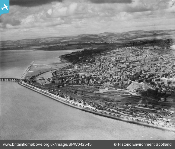
SPW042545 SCOTLAND (1933). Dundee, general view, showing Nethergate and Riverside Drive. An oblique aerial photograph taken facing north-west.
© Copyright OpenStreetMap contributors and licensed by the OpenStreetMap Foundation. 2025. Cartography is licensed as CC BY-SA.
Nearby Images (2)
SPW042545

SPW040569

Details
| Title | [SPW042545] Dundee, general view, showing Nethergate and Riverside Drive. An oblique aerial photograph taken facing north-west. |
| Reference | SPW042545 |
| Date | 1933 |
| Link | NRHE Collection item 1257638 |
| Place name | |
| Parish | DUNDEE (DUNDEE, CITY OF) |
| District | CITY OF DUNDEE |
| Country | SCOTLAND |
| Easting / Northing | 338920, 729620 |
| Longitude / Latitude | -2.9911380853789, 56.454875898764 |
| National Grid Reference | NO389296 |
Pins

chiffchaffbirdy |
Sunday 27th of November 2016 09:06:39 PM | |
|
chiffchaffbirdy |
Sunday 27th of November 2016 09:05:27 PM | |
|
chiffchaffbirdy |
Sunday 27th of November 2016 09:03:41 PM | |
|
Graham Yaxley |
Wednesday 18th of February 2015 11:29:58 PM | |
|
2FFY |
Tuesday 27th of January 2015 04:00:24 PM | |
|
2FFY |
Tuesday 27th of January 2015 03:59:58 PM | |
|
gerry-r |
Tuesday 8th of July 2014 08:21:26 PM | |
|
Chris Willis |
Thursday 2nd of January 2014 07:29:21 PM | |
|
Chris Willis |
Thursday 2nd of January 2014 07:28:25 PM |