
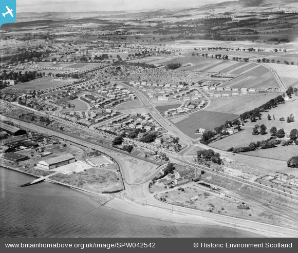
SPW042542 SCOTLAND (1933). Dundee, general view, showing Broughty Ferry Road and Craigie Avenue. An oblique aerial photograph taken facing north.
© Copyright OpenStreetMap contributors and licensed by the OpenStreetMap Foundation. 2025. Cartography is licensed as CC BY-SA.
Nearby Images (2)
SPW019924

SPW042542

Details
| Title | [SPW042542] Dundee, general view, showing Broughty Ferry Road and Craigie Avenue. An oblique aerial photograph taken facing north. |
| Reference | SPW042542 |
| Date | 1933 |
| Link | Canmore Collection item 1257636 |
| Place name | |
| Parish | DUNDEE (DUNDEE, CITY OF) |
| District | CITY OF DUNDEE |
| Country | SCOTLAND |
| Easting / Northing | 342888, 731411 |
| Longitude / Latitude | -2.927151635445, 56.471463366723 |
| National Grid Reference | NO429314 |
Pins
 ronwkidd |
Tuesday 2nd of August 2016 09:41:07 PM | |
irmurray |
Thursday 24th of April 2014 01:24:13 PM | |
Stobieer |
Wednesday 22nd of January 2014 03:12:17 AM | |
Mid Craigie not built yet in 1933. This is Clepington Road |
JW300 |
Sunday 21st of June 2020 06:57:57 PM |
Stobieer |
Wednesday 22nd of January 2014 03:10:33 AM | |
geeziz |
Tuesday 26th of June 2012 04:49:40 AM |
User Comment Contributions
Further to my last comment, they stayed in a house which was angled to Greendykes Road and there was at the time vacant ground opposite their house. |
ronwkidd |
Tuesday 2nd of August 2016 09:39:53 PM |
I may be wrong, but I think this photo has been printed in reverse. I had cousins who stayed in Carlochie Place, were married in Craigie Church AND IT'S ALL ON THE WRONG SIDE OF THE ROAD. Furthmore, the junction with the main east / west road at the top of of the pic is the wrong way round!! |
ronwkidd |
Tuesday 2nd of August 2016 09:33:00 PM |