
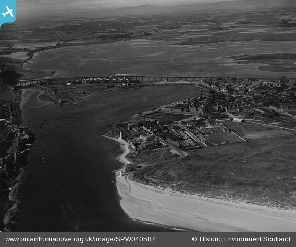
SPW040587 SCOTLAND (1932). Montrose, general view, showing Montrose Harbour and Rossie Island. An oblique aerial photograph taken facing west. This image has been produced from a print.
© Copyright OpenStreetMap contributors and licensed by the OpenStreetMap Foundation. 2026. Cartography is licensed as CC BY-SA.
Nearby Images (5)
SAW051246

SPW040587

SAR036015

SPW033639

SAW051248

Details
| Title | [SPW040587] Montrose, general view, showing Montrose Harbour and Rossie Island. An oblique aerial photograph taken facing west. This image has been produced from a print. |
| Reference | SPW040587 |
| Date | 1932 |
| Link | NRHE Collection item 1315573 |
| Place name | |
| Parish | MONTROSE |
| District | ANGUS |
| Country | SCOTLAND |
| Easting / Northing | 371584, 757024 |
| Longitude / Latitude | -2.4641405336334, 56.704190149893 |
| National Grid Reference | NO716570 |
Pins

Celurca |
Tuesday 2nd of March 2021 02:52:02 PM | |
|
bernoullis |
Wednesday 22nd of April 2020 09:01:01 PM |