
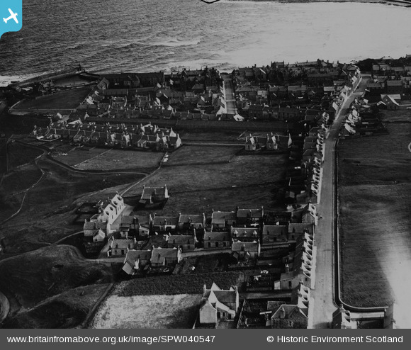
SPW040547 SCOTLAND (1932). Banff, general view, showing St Catherine Street and Clunie Street. An oblique aerial photograph taken facing east. This image has been produced from a print.
© Copyright OpenStreetMap contributors and licensed by the OpenStreetMap Foundation. 2026. Cartography is licensed as CC BY-SA.
Nearby Images (3)
SPW040547

SPW022098

SPW022101

Details
| Title | [SPW040547] Banff, general view, showing St Catherine Street and Clunie Street. An oblique aerial photograph taken facing east. This image has been produced from a print. |
| Reference | SPW040547 |
| Date | 1932 |
| Link | NRHE Collection item 1315538 |
| Place name | |
| Parish | BANFF |
| District | BANFF AND BUCHAN |
| Country | SCOTLAND |
| Easting / Northing | 368584, 864458 |
| Longitude / Latitude | -2.5266965431257, 57.669148436425 |
| National Grid Reference | NJ686645 |
Pins
Be the first to add a comment to this image!