
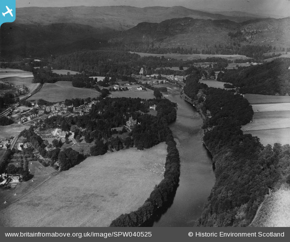
SPW040525 SCOTLAND (1932). Birnam, general view, showing Torwood House, St Mary's Road and Dunkeld Bridge. An oblique aerial photograph taken facing north-west. This image has been produced from a print.
© Copyright OpenStreetMap contributors and licensed by the OpenStreetMap Foundation. 2026. Cartography is licensed as CC BY-SA.
Nearby Images (2)
SPW040525

SPW033673

Details
| Title | [SPW040525] Birnam, general view, showing Torwood House, St Mary's Road and Dunkeld Bridge. An oblique aerial photograph taken facing north-west. This image has been produced from a print. |
| Reference | SPW040525 |
| Date | 1932 |
| Link | NRHE Collection item 1315526 |
| Place name | |
| Parish | LITTLE DUNKELD |
| District | PERTH AND KINROSS |
| Country | SCOTLAND |
| Easting / Northing | 303251, 741949 |
| Longitude / Latitude | -3.5743173605284, 56.559641675088 |
| National Grid Reference | NO033419 |
Pins
Be the first to add a comment to this image!