
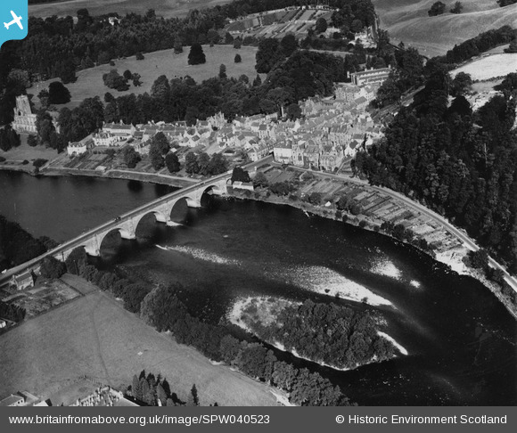
SPW040523 SCOTLAND (1932). Dunkeld, general view, showing Dunkeld Bridge and Shiochie's Hill. An oblique aerial photograph taken facing north-west. This image has been produced from a print.
© Copyright OpenStreetMap contributors and licensed by the OpenStreetMap Foundation. 2026. Cartography is licensed as CC BY-SA.
Nearby Images (12)
SPW040523

SPW040524

SPW040526

SPW033672

SAR016728

SAR016729

SAR016730

SPW033669

SAR016726

SAR016727

SPW033667

SPW033668

Details
| Title | [SPW040523] Dunkeld, general view, showing Dunkeld Bridge and Shiochie's Hill. An oblique aerial photograph taken facing north-west. This image has been produced from a print. |
| Reference | SPW040523 |
| Date | 1932 |
| Link | NRHE Collection item 1315524 |
| Place name | |
| Parish | DUNKELD AND DOWALLY |
| District | PERTH AND KINROSS |
| Country | SCOTLAND |
| Easting / Northing | 302714, 742592 |
| Longitude / Latitude | -3.5832929929707, 56.565305856954 |
| National Grid Reference | NO027426 |
Pins
Be the first to add a comment to this image!