
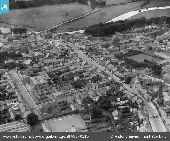
SPW040215 SCOTLAND (1932). Annan, general view, showing High Street and Ednam Street. An oblique aerial photograph taken facing west.
© Copyright OpenStreetMap contributors and licensed by the OpenStreetMap Foundation. 2026. Cartography is licensed as CC BY-SA.
Nearby Images (14)
SPW040215

SPW029236

SPW029235

SPW029232

SAR019951

SAR019952

SPW029234

SAW043379

SAW043380

SPW040218

SPW029230

SPW040217

SPW029231

SPW040219

Details
| Title | [SPW040215] Annan, general view, showing High Street and Ednam Street. An oblique aerial photograph taken facing west. |
| Reference | SPW040215 |
| Date | 1932 |
| Link | NRHE Collection item 1257293 |
| Place name | |
| Parish | ANNAN |
| District | ANNANDALE AND ESKDALE |
| Country | SCOTLAND |
| Easting / Northing | 319394, 566569 |
| Longitude / Latitude | -3.2598408875039, 54.987108010783 |
| National Grid Reference | NY194666 |
Pins

Billy Turner |
Thursday 31st of December 2015 09:47:21 PM |
User Comment Contributions

One of the images inspiring the Annan from Above writers group due to be published in September 2014. |

Borders Project |
Wednesday 13th of August 2014 12:39:58 PM |