
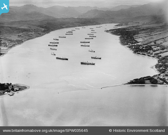
SPW035645 SCOTLAND (1931). Gare Loch, general view, showing Rhu Point and merchant shipping. An oblique aerial photograph taken facing north.
© Copyright OpenStreetMap contributors and licensed by the OpenStreetMap Foundation. 2025. Cartography is licensed as CC BY-SA.
Nearby Images (4)
SPW035643

SPW035644

SPW035645

SPW035646

Details
| Title | [SPW035645] Gare Loch, general view, showing Rhu Point and merchant shipping. An oblique aerial photograph taken facing north. |
| Reference | SPW035645 |
| Date | 1931 |
| Link | Canmore Collection item 1259433 |
| Place name | |
| Parish | RHU |
| District | DUMBARTON |
| Country | SCOTLAND |
| Easting / Northing | 226111, 683523 |
| Longitude / Latitude | -4.7897463027422, 56.013081918495 |
| National Grid Reference | NS261835 |
Pins
 Sarah |
Wednesday 10th of July 2013 05:19:34 PM |