
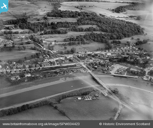
SPW034423 SCOTLAND (1930). Kirkcudbright, general view, showing Kirkcudbright Bridge and St Cuthbert Road. An oblique aerial photograph taken facing south-east.
© Copyright OpenStreetMap contributors and licensed by the OpenStreetMap Foundation. 2026. Cartography is licensed as CC BY-SA.
Nearby Images (9)
SPW034423

SAR019175

SAW011712

SAW011713

SAW011715

SAW011716

SAW011717

SPW034427

SPW034428

Details
| Title | [SPW034423] Kirkcudbright, general view, showing Kirkcudbright Bridge and St Cuthbert Road. An oblique aerial photograph taken facing south-east. |
| Reference | SPW034423 |
| Date | 1930 |
| Link | NRHE Collection item 1257146 |
| Place name | |
| Parish | KIRKCUDBRIGHT |
| District | STEWARTRY |
| Country | SCOTLAND |
| Easting / Northing | 268612, 551150 |
| Longitude / Latitude | -4.0460480253448, 54.837816017719 |
| National Grid Reference | NX686512 |
Pins

James Wells |
Saturday 17th of February 2024 03:37:53 PM | |

Chaz |
Wednesday 15th of September 2021 02:07:03 PM | |
|
Chaz |
Wednesday 15th of September 2021 02:02:33 PM | |
|
Chaz |
Wednesday 15th of September 2021 01:58:45 PM | |
|
Chris Willis |
Saturday 30th of November 2013 11:16:50 AM | |
|
Chris Willis |
Saturday 30th of November 2013 11:15:59 AM | |
|
Chris Willis |
Saturday 30th of November 2013 11:15:19 AM | |
|
Chris Willis |
Saturday 30th of November 2013 11:14:43 AM |