
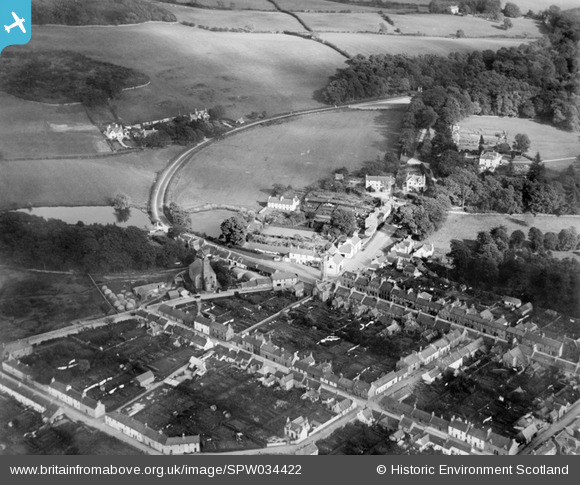
SPW034422 SCOTLAND (1930). Gatehouse of Fleet, general view, showing Old Military Road and Castramont Road. An oblique aerial photograph taken facing east.
© Copyright OpenStreetMap contributors and licensed by the OpenStreetMap Foundation. 2025. Cartography is licensed as CC BY-SA.
Nearby Images (5)
SPW034422

SPW034419

SAR019179

SPW034421

SPW034420

Details
| Title | [SPW034422] Gatehouse of Fleet, general view, showing Old Military Road and Castramont Road. An oblique aerial photograph taken facing east. |
| Reference | SPW034422 |
| Date | 1930 |
| Link | NRHE Collection item 1257145 |
| Place name | |
| Parish | GIRTHON |
| District | STEWARTRY |
| Country | SCOTLAND |
| Easting / Northing | 260182, 556454 |
| Longitude / Latitude | -4.1797911550541, 54.883168633131 |
| National Grid Reference | NX602565 |
Pins
Be the first to add a comment to this image!