
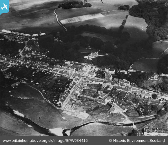
SPW034416 SCOTLAND (1930). Creetown, general view, showing Hill of Burns, High Road and St John Street. An oblique aerial photograph taken facing north-east. This image has been produced from a print.
© Copyright OpenStreetMap contributors and licensed by the OpenStreetMap Foundation. 2025. Cartography is licensed as CC BY-SA.
Nearby Images (5)
SPW034416

SPW034412

SPW034414

SPW034415

SPW034413

Details
| Title | [SPW034416] Creetown, general view, showing Hill of Burns, High Road and St John Street. An oblique aerial photograph taken facing north-east. This image has been produced from a print. |
| Reference | SPW034416 |
| Date | 1930 |
| Link | Canmore Collection item 1315503 |
| Place name | |
| Parish | KIRKMABRECK |
| District | WIGTOWN |
| Country | SCOTLAND |
| Easting / Northing | 247560, 558672 |
| Longitude / Latitude | -4.3775633888858, 54.899397152953 |
| National Grid Reference | NX476587 |
Pins
 [eBay} - Copy_0.jpg) ChesterMan |
Thursday 23rd of October 2014 03:26:42 PM | |
ChesterMan |
Thursday 23rd of October 2014 03:21:47 PM | |
ChesterMan |
Thursday 23rd of October 2014 03:21:12 PM | |
ChesterMan |
Thursday 23rd of October 2014 03:20:34 PM | |
ChesterMan |
Thursday 23rd of October 2014 03:19:33 PM |