
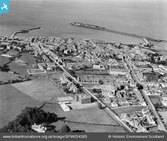
SPW034385 SCOTLAND (1930). Stranraer, general view, showing Stranraer Harbour and Lewis Street. An oblique aerial photograph taken facing north.
© Copyright OpenStreetMap contributors and licensed by the OpenStreetMap Foundation. 2025. Cartography is licensed as CC BY-SA.
Nearby Images (2)
SPW034385

SPW034386

Details
| Title | [SPW034385] Stranraer, general view, showing Stranraer Harbour and Lewis Street. An oblique aerial photograph taken facing north. |
| Reference | SPW034385 |
| Date | 1930 |
| Link | NRHE Collection item 1257111 |
| Place name | |
| Parish | STRANRAER |
| District | WIGTOWN |
| Country | SCOTLAND |
| Easting / Northing | 206059, 560597 |
| Longitude / Latitude | -5.0252421547223, 54.902296004701 |
| National Grid Reference | NX061606 |
