
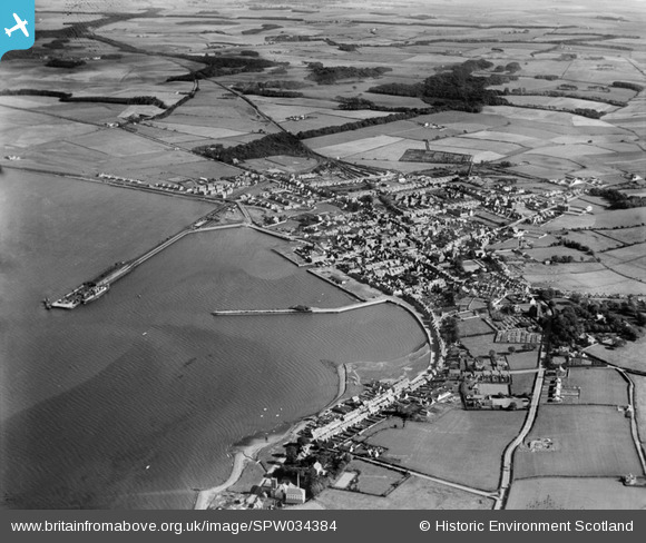
SPW034384 SCOTLAND (1930). Stranraer, general view, showing Stranraer Harbour and Culhorn. An oblique aerial photograph taken facing east.
© Copyright OpenStreetMap contributors and licensed by the OpenStreetMap Foundation. 2026. Cartography is licensed as CC BY-SA.
Nearby Images (2)
SPW034384

SPW034387

Details
| Title | [SPW034384] Stranraer, general view, showing Stranraer Harbour and Culhorn. An oblique aerial photograph taken facing east. |
| Reference | SPW034384 |
| Date | 1930 |
| Link | NRHE Collection item 1257110 |
| Place name | |
| Parish | STRANRAER |
| District | WIGTOWN |
| Country | SCOTLAND |
| Easting / Northing | 206120, 560960 |
| Longitude / Latitude | -5.0245365145529, 54.905577538297 |
| National Grid Reference | NX061610 |
Pins

MB |
Monday 8th of April 2013 05:17:30 PM | |
|
MB |
Monday 8th of April 2013 05:16:00 PM | |
|
MB |
Monday 8th of April 2013 05:10:33 PM | |
|
MB |
Monday 8th of April 2013 05:09:44 PM |