
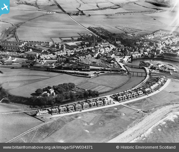
SPW034371 SCOTLAND (1930). Girvan, general view, showing Golf Course Road and Old Street. An oblique aerial photograph taken facing south-east.
© Copyright OpenStreetMap contributors and licensed by the OpenStreetMap Foundation. 2026. Cartography is licensed as CC BY-SA.
Nearby Images (3)
SPW034371

SPW051053

SPW034372

Details
| Title | [SPW034371] Girvan, general view, showing Golf Course Road and Old Street. An oblique aerial photograph taken facing south-east. |
| Reference | SPW034371 |
| Date | 1930 |
| Link | NRHE Collection item 1257092 |
| Place name | |
| Parish | GIRVAN |
| District | KYLE AND CARRICK |
| Country | SCOTLAND |
| Easting / Northing | 218469, 598281 |
| Longitude / Latitude | -4.855946455296, 55.245211119333 |
| National Grid Reference | NX185983 |
Pins

MB |
Saturday 10th of September 2016 10:54:04 AM | |
|
MB |
Saturday 10th of September 2016 10:52:53 AM | |
|
MB |
Saturday 10th of September 2016 10:52:17 AM | |
|
Alan McFarlane |
Wednesday 17th of April 2013 06:47:25 PM | |
|
McWhirter |
Monday 9th of July 2012 12:31:15 PM | |
|
McWhirter |
Monday 9th of July 2012 12:29:43 PM | |
|
McWhirter |
Monday 9th of July 2012 12:28:31 PM |