
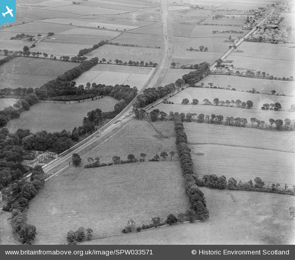
SPW033571 SCOTLAND (1930). The A8 Glasgow and Edinburgh Road, Whitburn. An oblique aerial photograph taken facing east.
© Copyright OpenStreetMap contributors and licensed by the OpenStreetMap Foundation. 2025. Cartography is licensed as CC BY-SA.
Nearby Images (4)
SPW027242

SPW027243

SPW033571

SPW033574

Details
| Title | [SPW033571] The A8 Glasgow and Edinburgh Road, Whitburn. An oblique aerial photograph taken facing east. |
| Reference | SPW033571 |
| Date | 1930 |
| Link | NRHE Collection item 1256925 |
| Place name | |
| Parish | WHITBURN |
| District | WEST LOTHIAN |
| Country | SCOTLAND |
| Easting / Northing | 292635, 664888 |
| Longitude / Latitude | -3.7157765839729, 55.865224418315 |
| National Grid Reference | NS926649 |
Pins
Be the first to add a comment to this image!
User Comment Contributions
What surprises me that the Cultsykefoot Cottages weren't even built. I thought they were much older. |

Big Craigie |
Tuesday 26th of June 2012 12:50:02 PM |