
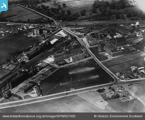
SPW027430 SCOTLAND (1929). Drybrough's Brewery and Maclachlan's Castle Ales Brewery, Duddingston Road West, Edinburgh. An oblique aerial photograph taken facing north. This image has been produced from a print.
© Copyright OpenStreetMap contributors and licensed by the OpenStreetMap Foundation. 2025. Cartography is licensed as CC BY-SA.
Nearby Images (2)
SPW027430

SPW027439

Details
| Title | [SPW027430] Drybrough's Brewery and Maclachlan's Castle Ales Brewery, Duddingston Road West, Edinburgh. An oblique aerial photograph taken facing north. This image has been produced from a print. |
| Reference | SPW027430 |
| Date | 1929 |
| Link | NRHE Collection item 1315472 |
| Place name | |
| Parish | EDINBURGH (EDINBURGH, CITY OF) |
| District | CITY OF EDINBURGH |
| Country | SCOTLAND |
| Easting / Northing | 328666, 671792 |
| Longitude / Latitude | -3.1419545745272, 55.933929386259 |
| National Grid Reference | NT287718 |
Pins

Andy A |
Tuesday 10th of November 2015 01:25:43 AM | |
|
Andy A |
Tuesday 10th of November 2015 01:22:24 AM | |
|
Andy A |
Tuesday 10th of November 2015 01:15:30 AM | |
|
Andy A |
Tuesday 10th of November 2015 01:14:56 AM | |
|
Andy A |
Tuesday 10th of November 2015 01:14:15 AM | |
|
Andy A |
Tuesday 10th of November 2015 01:13:41 AM | |
|
Andy A |
Tuesday 10th of November 2015 01:13:09 AM | |
|
Tam Smith |
Thursday 24th of July 2014 08:35:34 PM | |
|
Tam Smith |
Thursday 24th of July 2014 08:33:25 PM | |
|
Tam Smith |
Thursday 24th of July 2014 08:28:58 PM | |
|
Tam Smith |
Thursday 24th of July 2014 08:28:08 PM | |
|
Tam Smith |
Thursday 24th of July 2014 08:24:02 PM | |
|
Tam Smith |
Thursday 24th of July 2014 08:21:40 PM |