
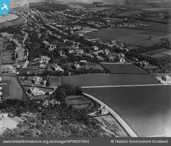
SPW027364 SCOTLAND (1929). North Berwick, general view, showing Dirleton Avenue and Cromwell Road. An oblique aerial photograph taken facing east. This image has been produced from a print.
© Copyright OpenStreetMap contributors and licensed by the OpenStreetMap Foundation. 2025. Cartography is licensed as CC BY-SA.
Nearby Images (4)
SPW027364

SPW027363

SAR018908
 North Berwick, East Lothian, Scotland. An oblique aerial photograph taken facing South/East. This image was marked by AeroPictorial Ltd for photo editing.")
SPW027366

Details
| Title | [SPW027364] North Berwick, general view, showing Dirleton Avenue and Cromwell Road. An oblique aerial photograph taken facing east. This image has been produced from a print. |
| Reference | SPW027364 |
| Date | 1929 |
| Link | Canmore Collection item 1315453 |
| Place name | |
| Parish | NORTH BERWICK |
| District | EAST LOTHIAN |
| Country | SCOTLAND |
| Easting / Northing | 354010, 685310 |
| Longitude / Latitude | -2.7385944153964, 56.058480831109 |
| National Grid Reference | NT540853 |
Pins
Be the first to add a comment to this image!