
SPW027131 SCOTLAND (1929). Edinburgh, general view, showing Princes Street and Edinburgh Castle. An oblique aerial photograph taken facing north-east. This image has been produced from a marked print.

© Copyright OpenStreetMap contributors and licensed by the OpenStreetMap Foundation. 2026. Cartography is licensed as CC BY-SA.
Nearby Images (39)
SPW027131

SAW009821

SAW010251

SAW010253

SAW010260

SPW040193

SPW027132

SAR010385

SAR010386

SAR010458

SAR011155

SAR033373

SAR033375

SAR033376

SAW014850

SAW014851

SAW032074

SAW036195

SAW036196

SPW017703

SAW010250

SPW027325

SAW032075

SPW027331

SAW032076

SAW032077

SPW027332

SPW040195

SAR008700

SAR008701

SAR021179

SAR021181

SAR021202

SAR022326

SAR029124

SAR029125

SAR029126

SAR033371

SAR033377

Details
| Title | [SPW027131] Edinburgh, general view, showing Princes Street and Edinburgh Castle. An oblique aerial photograph taken facing north-east. This image has been produced from a marked print. |
| Reference | SPW027131 |
| Date | 1929 |
| Link | NRHE Collection item 1315406 |
| Place name | |
| Parish | EDINBURGH (EDINBURGH, CITY OF) |
| District | CITY OF EDINBURGH |
| Country | SCOTLAND |
| Easting / Northing | 325016, 673652 |
| Longitude / Latitude | -3.2008887253122, 55.950084033431 |
| National Grid Reference | NT250737 |
Pins

melgibbs |
Tuesday 25th of February 2014 09:45:40 PM |

User Comment Contributions
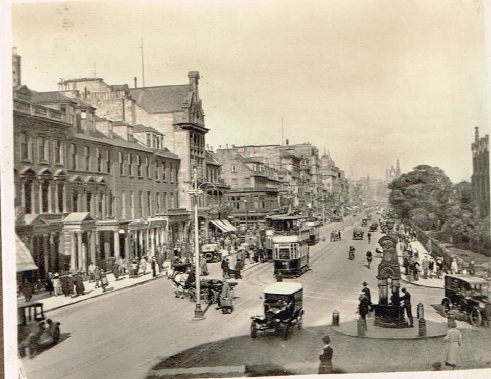
Princes Street, Edinburgh looking east, Easter 1933. From a family album. |

Class31 |
Thursday 15th of January 2015 12:37:17 PM |