
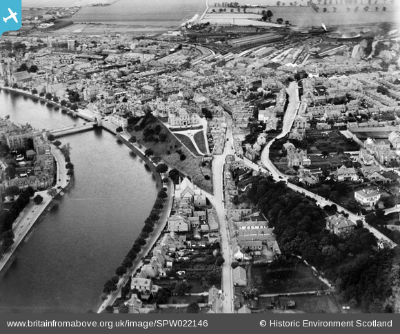
SPW022146 SCOTLAND (1928). Inverness, general view, showing Inverness Castle and Ness Bridge. An oblique aerial photograph taken facing north.
© Copyright OpenStreetMap contributors and licensed by the OpenStreetMap Foundation. 2026. Cartography is licensed as CC BY-SA.
Nearby Images (13)
SPW022146

SPW040500

SPW022148

SAW003579

SPW022144

SPW022149

SPW040498

SPW033826

SPW033829

SPW040499

SPW033833

SPW022145

SPW033825

Details
| Title | [SPW022146] Inverness, general view, showing Inverness Castle and Ness Bridge. An oblique aerial photograph taken facing north. |
| Reference | SPW022146 |
| Date | 1928 |
| Link | NRHE Collection item 1256515 |
| Place name | |
| Parish | INVERNESS AND BONA |
| District | INVERNESS |
| Country | SCOTLAND |
| Easting / Northing | 266645, 845032 |
| Longitude / Latitude | -4.2241476312992, 57.476122119764 |
| National Grid Reference | NH666450 |
Pins

oldhall |
Monday 4th of November 2013 04:29:49 PM |