
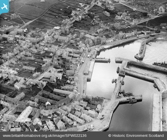
SPW022136 SCOTLAND (1928). Macduff, general view, showing Macduff Harbour and Crook O'Ness Street. An oblique aerial photograph taken facing south.
© Copyright OpenStreetMap contributors and licensed by the OpenStreetMap Foundation. 2025. Cartography is licensed as CC BY-SA.
Nearby Images (7)
SPW022136

SPW040542

SPW022134

SPW022138

SAR033572

SPW040540

SPW022137

Details
| Title | [SPW022136] Macduff, general view, showing Macduff Harbour and Crook O'Ness Street. An oblique aerial photograph taken facing south. |
| Reference | SPW022136 |
| Date | 1928 |
| Link | NRHE Collection item 1256506 |
| Place name | |
| Parish | GAMRIE |
| District | BANFF AND BUCHAN |
| Country | SCOTLAND |
| Easting / Northing | 370399, 864673 |
| Longitude / Latitude | -2.4962953728483, 57.671202768661 |
| National Grid Reference | NJ704647 |
Pins
Be the first to add a comment to this image!