
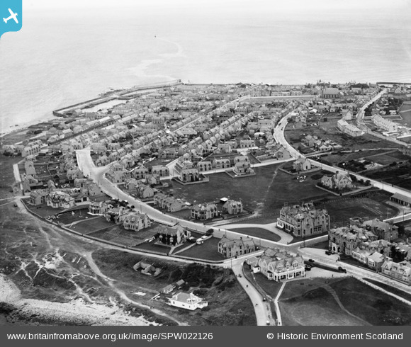
SPW022126 SCOTLAND (1928). Lossiemouth, general view, showing Stotfield Road and Kimberly Street. An oblique aerial photograph taken facing east.
© Copyright OpenStreetMap contributors and licensed by the OpenStreetMap Foundation. 2025. Cartography is licensed as CC BY-SA.
Nearby Images (2)
SPW022126

SPW040550

Details
| Title | [SPW022126] Lossiemouth, general view, showing Stotfield Road and Kimberly Street. An oblique aerial photograph taken facing east. |
| Reference | SPW022126 |
| Date | 1928 |
| Link | Canmore Collection item 1256496 |
| Place name | |
| Parish | DRAINIE |
| District | MORAY |
| Country | SCOTLAND |
| Easting / Northing | 323285, 871106 |
| Longitude / Latitude | -3.2881080310383, 57.723415390113 |
| National Grid Reference | NJ233711 |
Pins
 Chris B |
Friday 25th of December 2015 04:44:58 PM |
User Comment Contributions
Better view of the driveway at the Marine Hotel and the Big Greenie. James Crescent above and Dunbar street just visible at the top. Bottom left corner is where the lead min shaft was, now capped with concrete circular slab. |
Donnie |
Sunday 1st of December 2013 08:48:56 PM |