
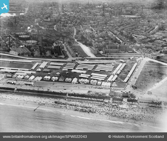
SPW022043 SCOTLAND (1928). Aberdeen, general view, showing Footdee and Queen's Links. Highland Agricultural Show. An oblique aerial photograph taken facing west.
© Copyright OpenStreetMap contributors and licensed by the OpenStreetMap Foundation. 2025. Cartography is licensed as CC BY-SA.
Nearby Images (2)
SPW022043

SPW022042

Details
| Title | [SPW022043] Aberdeen, general view, showing Footdee and Queen's Links. Highland Agricultural Show. An oblique aerial photograph taken facing west. |
| Reference | SPW022043 |
| Date | 1928 |
| Link | NRHE Collection item 1259280 |
| Place name | |
| Parish | ABERDEEN |
| District | CITY OF ABERDEEN |
| Country | SCOTLAND |
| Easting / Northing | 395210, 806730 |
| Longitude / Latitude | -2.0791804245811, 57.151608111792 |
| National Grid Reference | NJ952067 |
Pins
Be the first to add a comment to this image!