
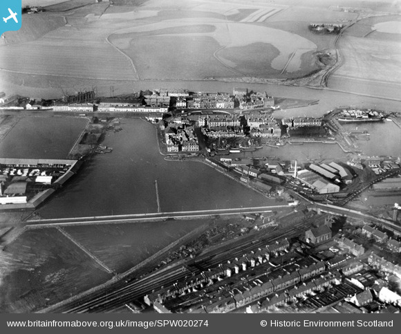
SPW020274 SCOTLAND (1928). Grangemouth East Basin and Junction Dock, Grangemouth. An oblique aerial photograph taken facing north-east.
© Copyright OpenStreetMap contributors and licensed by the OpenStreetMap Foundation. 2026. Cartography is licensed as CC BY-SA.
Nearby Images (5)
SPW020274

SAW018840

SAW018841

SAW018842

SPW017715

Details
| Title | [SPW020274] Grangemouth East Basin and Junction Dock, Grangemouth. An oblique aerial photograph taken facing north-east. |
| Reference | SPW020274 |
| Date | 1928 |
| Link | NRHE Collection item 1256680 |
| Place name | |
| Parish | GRANGEMOUTH |
| District | FALKIRK |
| Country | SCOTLAND |
| Easting / Northing | 292280, 682260 |
| Longitude / Latitude | -3.7283836682216, 56.021176297228 |
| National Grid Reference | NS923823 |
Pins
 |

Scotskiwi |
Saturday 16th of August 2014 04:23:39 AM |
|
Scotskiwi |
Wednesday 26th of February 2014 02:08:10 PM | |
|
Scotskiwi |
Wednesday 26th of February 2014 02:07:01 PM | |
|
Scotskiwi |
Wednesday 26th of February 2014 02:05:29 PM | |
|
Scotskiwi |
Wednesday 26th of February 2014 02:03:25 PM | |
|
Scotskiwi |
Wednesday 26th of February 2014 02:01:56 PM | |
|
Scotskiwi |
Wednesday 26th of February 2014 02:00:34 PM | |
|
Scotskiwi |
Wednesday 26th of February 2014 01:57:27 PM | |
|
Scotskiwi |
Wednesday 26th of February 2014 01:56:09 PM | |
|
Scotskiwi |
Wednesday 26th of February 2014 01:53:04 PM | |
|
Scotskiwi |
Wednesday 26th of February 2014 01:50:30 PM | |
|
Scotskiwi |
Wednesday 26th of February 2014 01:49:33 PM |


