
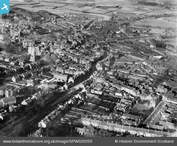
SPW020255 SCOTLAND (1928). Stirling, general view, showing Stirling Station and Port Street. An oblique aerial photograph taken facing north.
© Copyright OpenStreetMap contributors and licensed by the OpenStreetMap Foundation. 2026. Cartography is licensed as CC BY-SA.
Nearby Images (5)
SPW020255

SPW020316

SPW040342

SPW040343

SPW020257

Details
| Title | [SPW020255] Stirling, general view, showing Stirling Station and Port Street. An oblique aerial photograph taken facing north. |
| Reference | SPW020255 |
| Date | 1928 |
| Link | NRHE Collection item 1256661 |
| Place name | |
| Parish | STIRLING |
| District | STIRLING |
| Country | SCOTLAND |
| Easting / Northing | 279657, 693305 |
| Longitude / Latitude | -3.9357651075186, 56.117363303037 |
| National Grid Reference | NS797933 |
