
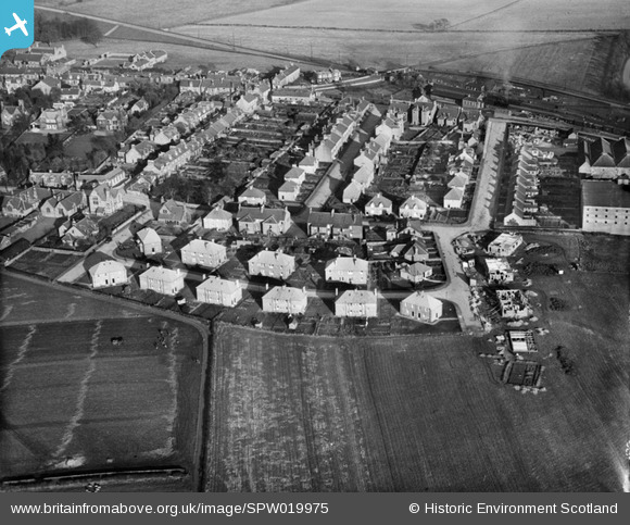
SPW019975 SCOTLAND (1927). Markinch, general view, showing Landel Street and Markinch Station. An oblique aerial photograph taken facing east.
© Copyright OpenStreetMap contributors and licensed by the OpenStreetMap Foundation. 2025. Cartography is licensed as CC BY-SA.
Nearby Images (5)
SAR016693

SPW019975

SPW040424

SPW019977

SPW040425

Details
| Title | [SPW019975] Markinch, general view, showing Landel Street and Markinch Station. An oblique aerial photograph taken facing east. |
| Reference | SPW019975 |
| Date | 1927 |
| Link | NRHE Collection item 1256165 |
| Place name | |
| Parish | MARKINCH |
| District | KIRKCALDY |
| Country | SCOTLAND |
| Easting / Northing | 329690, 701500 |
| Longitude / Latitude | -3.1333700914667, 56.200973967009 |
| National Grid Reference | NO297015 |
Pins
Be the first to add a comment to this image!