
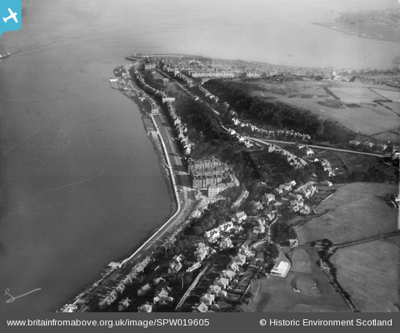
SPW019605 SCOTLAND (1927). Gourock, general view, showing West Bay and Tower Hill. An oblique aerial photograph taken facing east.
© Copyright OpenStreetMap contributors and licensed by the OpenStreetMap Foundation. 2025. Cartography is licensed as CC BY-SA.
Nearby Images (2)
SPW019605

SPW019604

Details
| Title | [SPW019605] Gourock, general view, showing West Bay and Tower Hill. An oblique aerial photograph taken facing east. |
| Reference | SPW019605 |
| Date | 1927 |
| Link | NRHE Collection item 1246326 |
| Place name | |
| Parish | INVERKIP |
| District | INVERCLYDE |
| Country | SCOTLAND |
| Easting / Northing | 223509, 677228 |
| Longitude / Latitude | -4.8273055537254, 55.955634884672 |
| National Grid Reference | NS235772 |
Pins

Tam |
Tuesday 19th of March 2013 07:59:49 AM | |
|
Tam |
Tuesday 19th of March 2013 07:59:10 AM | |
|
Tam |
Tuesday 19th of March 2013 07:58:48 AM | |
|
Tam |
Tuesday 19th of March 2013 07:58:12 AM | |
|
Tam |
Tuesday 19th of March 2013 07:57:46 AM |