
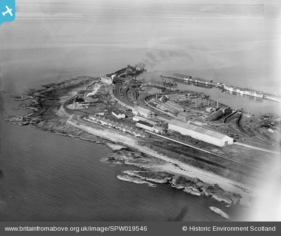
SPW019546 SCOTLAND (1927). Troon Harbour, general view. An oblique aerial photograph taken facing north.
© Copyright OpenStreetMap contributors and licensed by the OpenStreetMap Foundation. 2025. Cartography is licensed as CC BY-SA.
Nearby Images (2)
SPW019544

SPW019546

Details
| Title | [SPW019546] Troon Harbour, general view. An oblique aerial photograph taken facing north. |
| Reference | SPW019546 |
| Date | 1927 |
| Link | NRHE Collection item 1246309 |
| Place name | |
| Parish | MARITIME - SOUTH AYRSHIRE |
| District | MARITIME |
| Country | SCOTLAND |
| Easting / Northing | 230900, 631400 |
| Longitude / Latitude | -4.680677242685, 55.546932936012 |
| National Grid Reference | NS309314 |
Pins

MB |
Sunday 1st of December 2013 10:29:44 AM |
User Comment Contributions
Interestingly there is no Ballast Bank yet. |
Affric |
Wednesday 27th of June 2012 09:57:50 PM |