
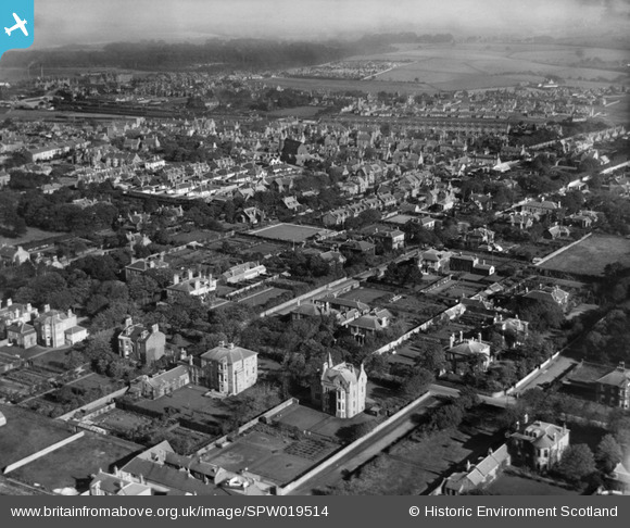
SPW019514 SCOTLAND (1927). Ayr, general view, showing Racecourse Road in the foreground. An oblique aerial photograph taken facing east.
© Copyright OpenStreetMap contributors and licensed by the OpenStreetMap Foundation. 2026. Cartography is licensed as CC BY-SA.
Nearby Images (2)
SPW019514

SAW022888

Details
| Title | [SPW019514] Ayr, general view, showing Racecourse Road in the foreground. An oblique aerial photograph taken facing east. |
| Reference | SPW019514 |
| Date | 1927 |
| Link | NRHE Collection item 1246289 |
| Place name | |
| Parish | AYR |
| District | KYLE AND CARRICK |
| Country | SCOTLAND |
| Easting / Northing | 233483, 620837 |
| Longitude / Latitude | -4.633439063257, 55.452997667864 |
| National Grid Reference | NS335208 |
Pins
Be the first to add a comment to this image!