
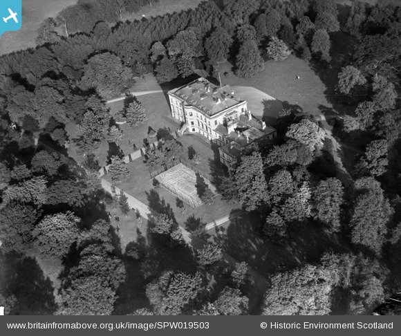
SPW019503 SCOTLAND (1927). Blythswood House, Renfrew. An oblique aerial photograph.
© Copyright OpenStreetMap contributors and licensed by the OpenStreetMap Foundation. 2026. Cartography is licensed as CC BY-SA.
Nearby Images (2)
SPW019503

SPW052993

Details
| Title | [SPW019503] Blythswood House, Renfrew. An oblique aerial photograph. |
| Reference | SPW019503 |
| Date | 1927 |
| Link | NRHE Collection item 1246279 |
| Place name | |
| Parish | RENFREW (RENFREW) |
| District | RENFREW |
| Country | SCOTLAND |
| Easting / Northing | 249870, 668720 |
| Longitude / Latitude | -4.4007402001728, 55.888210759512 |
| National Grid Reference | NS499687 |
Pins
Be the first to add a comment to this image!