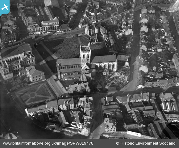
SPW019478 SCOTLAND (1927). Paisley Abbey, Abbey Close, also showing Paisley Town Hall. An oblique aerial photograph taken facing north.
© Copyright OpenStreetMap contributors and licensed by the OpenStreetMap Foundation. 2026. Cartography is licensed as CC BY-SA.
Nearby Images (7)
SPW019478

SPW050828

SPW056887

SPW019481

SPW056884

SPW056886

SPW050826

Details
| Title | [SPW019478] Paisley Abbey, Abbey Close, also showing Paisley Town Hall. An oblique aerial photograph taken facing north. |
| Reference | SPW019478 |
| Date | 1927 |
| Link | NRHE Collection item 1246263 |
| Place name | |
| Parish | PAISLEY (RENFREW) |
| District | RENFREW |
| Country | SCOTLAND |
| Easting / Northing | 248559, 663954 |
| Longitude / Latitude | -4.4190212401463, 55.845011641318 |
| National Grid Reference | NS486640 |