
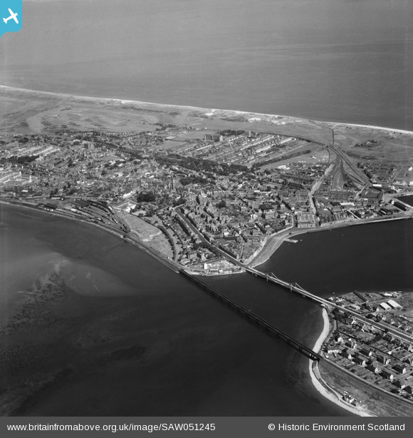
SAW051245 SCOTLAND (1953). Montrose, general view. An oblique aerial photograph taken facing east.
© Copyright OpenStreetMap contributors and licensed by the OpenStreetMap Foundation. 2026. Cartography is licensed as CC BY-SA.
Nearby Images (6)
SAW051245

SAW051244

SPW040586

SPW040584

SPW033638

SPW033640

Details
| Title | [SAW051245] Montrose, general view. An oblique aerial photograph taken facing east. |
| Reference | SAW051245 |
| Date | 1953 |
| Link | NRHE Collection item 1297906 |
| Place name | |
| Parish | MONTROSE |
| District | ANGUS |
| Country | SCOTLAND |
| Easting / Northing | 371345, 757587 |
| Longitude / Latitude | -2.4681069574011, 56.709233777521 |
| National Grid Reference | NO713576 |
Pins

ianADL |
Thursday 2nd of October 2025 12:09:34 PM | |
|
Celurca |
Tuesday 2nd of March 2021 02:19:05 PM | |
|
Celurca |
Tuesday 2nd of March 2021 02:14:50 PM | |
|
Celurca |
Tuesday 2nd of March 2021 02:13:05 PM | |
|
Celurca |
Tuesday 2nd of March 2021 02:12:05 PM | |
|
Celurca |
Tuesday 2nd of March 2021 02:11:24 PM |