
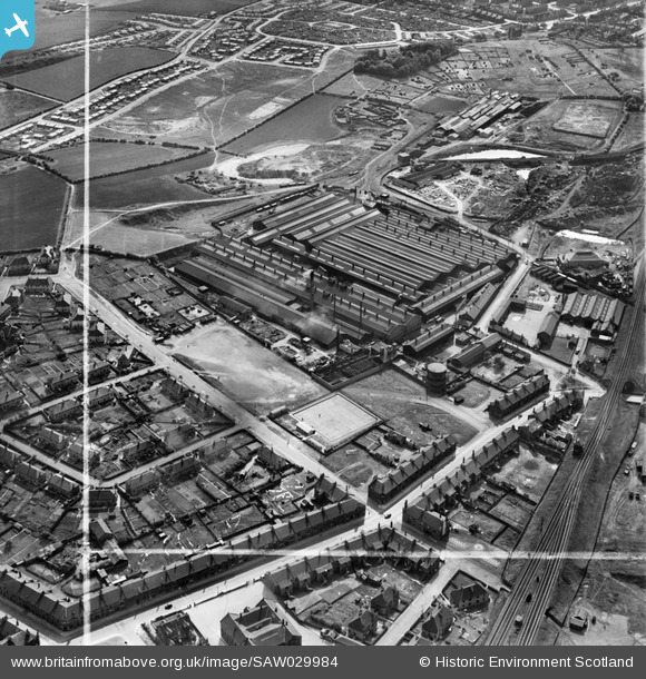
SAW029984 SCOTLAND (1950). Coatbridge, general view, showing Stewarts and Lloyds Ltd. Works, Souterhouse Road and Dundyvan Road. An oblique aerial photograph taken facing west. This image has been produced from a crop marked negative.
© Copyright OpenStreetMap contributors and licensed by the OpenStreetMap Foundation. 2026. Cartography is licensed as CC BY-SA.
Nearby Images (10)
SAW029976

SAW029977

SAW029978

SAW029979

SAW029980

SAW029981

SAW029982

SAW029983

SAW029984

SAW029985

Details
| Title | [SAW029984] Coatbridge, general view, showing Stewarts and Lloyds Ltd. Works, Souterhouse Road and Dundyvan Road. An oblique aerial photograph taken facing west. This image has been produced from a crop marked negative. |
| Reference | SAW029984 |
| Date | 1950 |
| Link | NRHE Collection item 1269632 |
| Place name | |
| Parish | OLD MONKLAND (MONKLANDS) |
| District | MONKLANDS |
| Country | SCOTLAND |
| Easting / Northing | 272744, 664142 |
| Longitude / Latitude | -4.0330929355211, 55.853685582074 |
| National Grid Reference | NS727641 |
Pins

jaypea |
Wednesday 28th of September 2016 07:27:26 PM | |
|
jaypea |
Wednesday 28th of September 2016 07:26:39 PM | |

Dylan Moore |
Saturday 24th of September 2016 02:34:59 PM | |
|
Dylan Moore |
Saturday 24th of September 2016 02:31:52 PM | |
|
Dylan Moore |
Saturday 24th of September 2016 02:25:49 PM | |
|
Dylan Moore |
Saturday 24th of September 2016 02:23:45 PM | |
|
jaypea |
Wednesday 17th of February 2016 08:52:33 PM | |
|
abc123 |
Sunday 21st of September 2014 04:23:54 PM |