
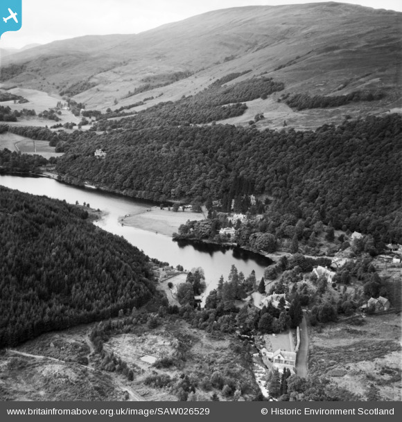
SAW026529 SCOTLAND (1949). Loch Ard, general view, showing Dundarroch and Corrienessan, Pass of Aberfoyle. An oblique aerial photograph taken facing north-west.
© Copyright OpenStreetMap contributors and licensed by the OpenStreetMap Foundation. 2026. Cartography is licensed as CC BY-SA.
Nearby Images (8)
SAW026529

 0°
0m
SAW026530
 0°
0m
SAW026528
 123°
246m
SAW026531
 123°
246m
SAW026532
 123°
246m
SAW026533
 123°
246m
SAW026534
 123°
246m
SAW026535
 135°
250m
Details
| Title | [SAW026529] Loch Ard, general view, showing Dundarroch and Corrienessan, Pass of Aberfoyle. An oblique aerial photograph taken facing north-west. |
| Reference | SAW026529 |
| Date | 1949 |
| Link | NRHE Collection item 1269376 |
| Place name | |
| Parish | ABERFOYLE |
| District | STIRLING |
| Country | SCOTLAND |
| Easting / Northing | 249874, 701609 |
| Longitude / Latitude | -4.4190856290678, 56.183480999819 |
| National Grid Reference | NN499016 |
Pins

Iain |
Saturday 4th of December 2021 12:22:00 PM |

 the Pass, Loch Ard Road, Aberfoyle- built by George Scott circa 1904