
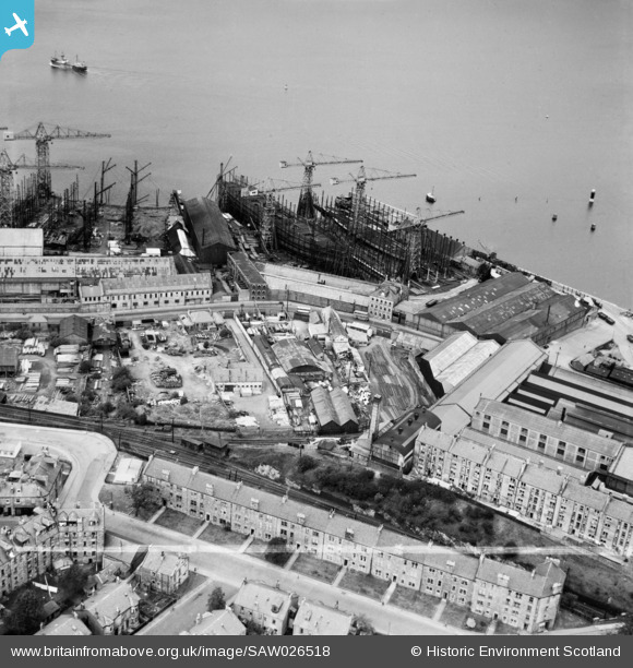
SAW026518 SCOTLAND (1949). Greenock, general view, showing Greenock Dockyard Co. Cartsdyke East Shipyard and Belville Street. An oblique aerial photograph taken facing north. This image has been produced from a crop marked negative.
© Copyright OpenStreetMap contributors and licensed by the OpenStreetMap Foundation. 2026. Cartography is licensed as CC BY-SA.
Nearby Images (8)
SAW026518

SAW006116

SAW006117

SAW006118

SAW006119

SAW006120

SAW006121

SAW026511

Details
| Title | [SAW026518] Greenock, general view, showing Greenock Dockyard Co. Cartsdyke East Shipyard and Belville Street. An oblique aerial photograph taken facing north. This image has been produced from a crop marked negative. |
| Reference | SAW026518 |
| Date | 1949 |
| Link | NRHE Collection item 1269365 |
| Place name | |
| Parish | GREENOCK |
| District | INVERCLYDE |
| Country | SCOTLAND |
| Easting / Northing | 229220, 675689 |
| Longitude / Latitude | -4.7349625767893, 55.943885084442 |
| National Grid Reference | NS292757 |
Pins
Be the first to add a comment to this image!