
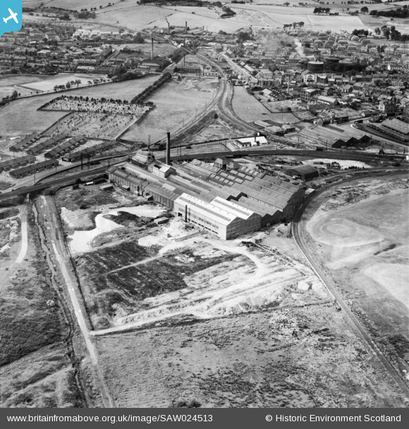
SAW024513 SCOTLAND (1949). Bathgate, general view, showing North British Steel Foundry Ltd. Balbardie Steel Works, Whitburn Road and Menzies Road. An oblique aerial photograph taken facing north.
© Copyright OpenStreetMap contributors and licensed by the OpenStreetMap Foundation. 2026. Cartography is licensed as CC BY-SA.
Nearby Images (13)
SAW024510

SAW024511

SAW024512

SAW024513

SAW024514

SAW024515

SAW024516

SAW024517

SAW024518

SAW024519

SAW024520

SAW024521

SPW027152

Details
| Title | [SAW024513] Bathgate, general view, showing North British Steel Foundry Ltd. Balbardie Steel Works, Whitburn Road and Menzies Road. An oblique aerial photograph taken facing north. |
| Reference | SAW024513 |
| Date | 1949 |
| Link | NRHE Collection item 1269341 |
| Place name | |
| Parish | BATHGATE |
| District | WEST LOTHIAN |
| Country | SCOTLAND |
| Easting / Northing | 297259, 668347 |
| Longitude / Latitude | -3.6432285764811, 55.897301550057 |
| National Grid Reference | NS973683 |
