
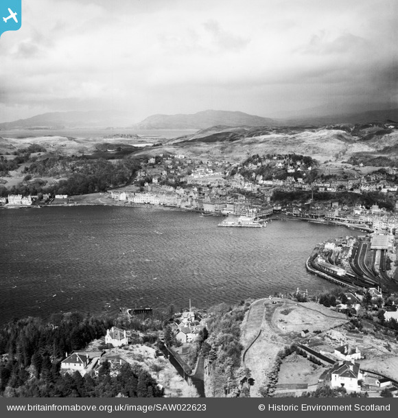
SAW022623 SCOTLAND (1949). Oban, general view, showing North Pier and Pulpit Hill. An oblique aerial photograph taken facing north-east.
© Copyright OpenStreetMap contributors and licensed by the OpenStreetMap Foundation. 2026. Cartography is licensed as CC BY-SA.
Nearby Images (15)
SAW022623

SAR018785

SPW022118

SAR018780

SAR018781

SAR018782

SAR018784

SAR018790

SAW022629

SAW029872

SPW022120

SAW022628

SAW022630

SAW029874

SPW022116

Details
| Title | [SAW022623] Oban, general view, showing North Pier and Pulpit Hill. An oblique aerial photograph taken facing north-east. |
| Reference | SAW022623 |
| Date | 1949 |
| Link | NRHE Collection item 1269205 |
| Place name | |
| Parish | KILMORE AND KILBRIDE |
| District | ARGYLL AND BUTE |
| Country | SCOTLAND |
| Easting / Northing | 185822, 730290 |
| Longitude / Latitude | -5.4726763900153, 56.416244003244 |
| National Grid Reference | NM858303 |
Pins

Billy Turner |
Tuesday 11th of November 2014 11:46:22 PM | |

Steve |
Monday 11th of November 2013 08:49:37 AM | |

Mounthooly |
Sunday 1st of July 2012 05:02:49 PM |
User Comment Contributions

Oban Distillery |
Mounthooly |
Sunday 1st of July 2012 04:51:00 PM |