
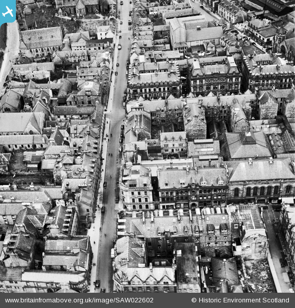
SAW022602 SCOTLAND (1949). Inverness, general view, showing Douglas Hotel, Union Street and Church Street. An oblique aerial photograph taken facing north.
© Copyright OpenStreetMap contributors and licensed by the OpenStreetMap Foundation. 2026. Cartography is licensed as CC BY-SA.
Nearby Images (21)
SAW022602

SAW022603

SPW040496

SAW022610

SAW022604

SAW022605

SAW022608

SAW022609

SAR016705

SAW022606

SAW022607

SPW022140

SPW040499

SPW022147

SPW033826

SAW019890

SPW022149

SPW022139

SAW003579

SPW022144

SAW019891

Details
| Title | [SAW022602] Inverness, general view, showing Douglas Hotel, Union Street and Church Street. An oblique aerial photograph taken facing north. |
| Reference | SAW022602 |
| Date | 1949 |
| Link | NRHE Collection item 1269030 |
| Place name | |
| Parish | INVERNESS AND BONA |
| District | INVERNESS |
| Country | SCOTLAND |
| Easting / Northing | 266600, 845360 |
| Longitude / Latitude | -4.2250765810013, 57.479053290816 |
| National Grid Reference | NH666454 |
Pins
Be the first to add a comment to this image!