
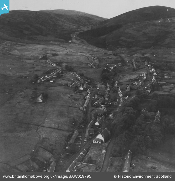
SAW019795 SCOTLAND (1948). Leadhills, general view. An oblique aerial photograph taken facing north. This image has been produced from a print.
© Copyright OpenStreetMap contributors and licensed by the OpenStreetMap Foundation. 2026. Cartography is licensed as CC BY-SA.
Nearby Images (3)
SAW019795

SAW019796

SAW019794

Details
| Title | [SAW019795] Leadhills, general view. An oblique aerial photograph taken facing north. This image has been produced from a print. |
| Reference | SAW019795 |
| Date | 1948 |
| Link | NRHE Collection item 1315096 |
| Place name | |
| Parish | CRAWFORD |
| District | CLYDESDALE |
| Country | SCOTLAND |
| Easting / Northing | 288489, 615007 |
| Longitude / Latitude | -3.7617683940191, 55.41625338686 |
| National Grid Reference | NS885150 |
Pins

Ken |
Sunday 23rd of March 2014 01:51:20 PM | |
|
Ken |
Sunday 23rd of March 2014 01:48:08 PM | |
|
Tam |
Wednesday 7th of August 2013 08:59:56 AM | |
|
Tam |
Wednesday 7th of August 2013 08:58:26 AM | |
|
Tam |
Wednesday 7th of August 2013 08:57:46 AM | |
|
Tam |
Wednesday 7th of August 2013 08:56:39 AM | |
|
Tam |
Wednesday 7th of August 2013 08:54:37 AM |