
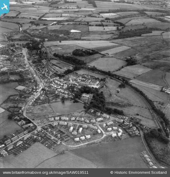
SAW019511 SCOTLAND (1948). General view, Lennoxtown, Stirlingshire, Scotland, 1948. An oblique Aerial photograph taken facing south.
© Copyright OpenStreetMap contributors and licensed by the OpenStreetMap Foundation. 2026. Cartography is licensed as CC BY-SA.
Nearby Images (3)
SAW019511

SAW019569

SAW019570

Details
| Title | [SAW019511] General view, Lennoxtown, Stirlingshire, Scotland, 1948. An oblique Aerial photograph taken facing south. |
| Reference | SAW019511 |
| Date | 1948 |
| Link | NRHE Collection item 1451831 |
| Place name | |
| Parish | CAMPSIE |
| District | STRATHKELVIN |
| Country | SCOTLAND |
| Easting / Northing | 262790, 677790 |
| Longitude / Latitude | -4.1989237200363, 55.973505977794 |
| National Grid Reference | NS628778 |
Pins

John Mitchell |
Thursday 23rd of October 2014 02:35:16 PM | |
|
John Mitchell |
Thursday 23rd of October 2014 02:34:39 PM |