
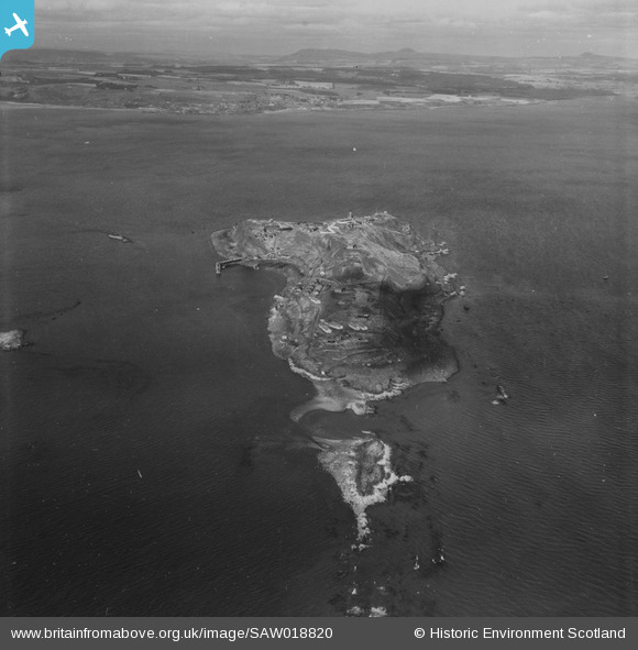
SAW018820 SCOTLAND (1948). Inchkeith, Firth of Forth. An oblique aerial photograph taken facing north. This image has been produced from a print.
© Copyright OpenStreetMap contributors and licensed by the OpenStreetMap Foundation. 2026. Cartography is licensed as CC BY-SA.
Nearby Images (2)
SAW018820

SAW018821

Details
| Title | [SAW018820] Inchkeith, Firth of Forth. An oblique aerial photograph taken facing north. This image has been produced from a print. |
| Reference | SAW018820 |
| Date | 1948 |
| Link | NRHE Collection item 1314870 |
| Place name | |
| Parish | KINGHORN |
| District | KIRKCALDY |
| Country | SCOTLAND |
| Easting / Northing | 329474, 682471 |
| Longitude / Latitude | -3.1318213689165, 56.029988966052 |
| National Grid Reference | NT295825 |
Pins

redmist |
Monday 10th of October 2022 11:41:45 AM | |
|
Andy A |
Friday 7th of August 2015 12:23:20 AM | |
|
Andy A |
Friday 7th of August 2015 12:22:57 AM | |
|
Andy A |
Friday 7th of August 2015 12:22:42 AM | |
|
Andy A |
Friday 7th of August 2015 12:21:45 AM | |
 |

Billy Turner |
Tuesday 23rd of June 2015 04:35:03 PM |
|
Billy Turner |
Tuesday 23rd of June 2015 04:18:27 PM |

User Comment Contributions

Whole island is covered in defences |

JMB |
Saturday 3rd of May 2014 10:31:04 PM |