
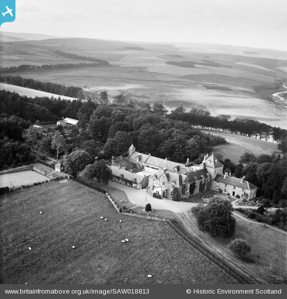
SAW018813 SCOTLAND (1948). Whitchester House, Longformacus. An oblique aerial photograph taken facing west.
© Copyright OpenStreetMap contributors and licensed by the OpenStreetMap Foundation. 2025. Cartography is licensed as CC BY-SA.
Nearby Images (4)
SAW018810

SAW018811

SAW018812

SAW018813

Details
| Title | [SAW018813] Whitchester House, Longformacus. An oblique aerial photograph taken facing west. |
| Reference | SAW018813 |
| Date | 1948 |
| Link | NRHE Collection item 1269121 |
| Place name | |
| Parish | LONGFORMACUS |
| District | BERWICKSHIRE |
| Country | SCOTLAND |
| Easting / Northing | 372031, 659007 |
| Longitude / Latitude | -2.4464652857067, 55.82352616143 |
| National Grid Reference | NT720590 |
Pins
Be the first to add a comment to this image!