
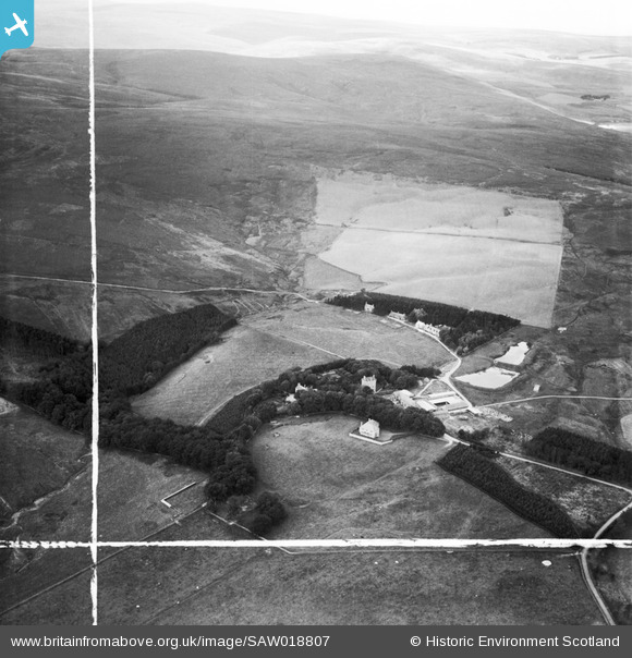
SAW018807 SCOTLAND (1948). Cranshaws Castle and grounds. An oblique aerial photograph taken facing west. This image has been produced from a crop marked negative.
© Copyright OpenStreetMap contributors and licensed by the OpenStreetMap Foundation. 2026. Cartography is licensed as CC BY-SA.
Nearby Images (5)
SAW018806

SAW018807

SAW018808

SAW018805

SAW018809

Details
| Title | [SAW018807] Cranshaws Castle and grounds. An oblique aerial photograph taken facing west. This image has been produced from a crop marked negative. |
| Reference | SAW018807 |
| Date | 1948 |
| Link | NRHE Collection item 1269115 |
| Place name | |
| Parish | CRANSHAWS |
| District | BERWICKSHIRE |
| Country | SCOTLAND |
| Easting / Northing | 368158, 661796 |
| Longitude / Latitude | -2.5086138827231, 55.848347201874 |
| National Grid Reference | NT682618 |
Pins
Be the first to add a comment to this image!