
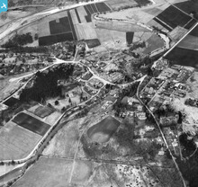
SAW014755 SCOTLAND (1948). Braemar, general view, showing Clunie Water and Glenshee Road. An oblique aerial photograph taken facing north.

© Copyright OpenStreetMap contributors and licensed by the OpenStreetMap Foundation. 2026. Cartography is licensed as CC BY-SA.
Nearby Images (3)
SAW014755

SAW014757

SAW014756

Details
| Title | [SAW014755] Braemar, general view, showing Clunie Water and Glenshee Road. An oblique aerial photograph taken facing north. |
| Reference | SAW014755 |
| Date | 1948 |
| Link | NRHE Collection item 1268881 |
| Place name | |
| Parish | CRATHIE AND BRAEMAR |
| District | KINCARDINE AND DEESIDE |
| Country | SCOTLAND |
| Easting / Northing | 315078, 791279 |
| Longitude / Latitude | -3.3983218915214, 57.005009317653 |
| National Grid Reference | NO151913 |
Pins

areed |
Wednesday 22nd of July 2020 06:57:57 PM | |
|
areed |
Wednesday 22nd of July 2020 06:54:36 PM | |
|
areed |
Wednesday 22nd of July 2020 06:53:23 PM | |
|
areed |
Wednesday 22nd of July 2020 06:51:29 PM | |
|
areed |
Wednesday 22nd of July 2020 06:50:11 PM | |
|
areed |
Wednesday 22nd of July 2020 06:47:04 PM | |
|
areed |
Wednesday 22nd of July 2020 06:45:58 PM | |
|
areed |
Wednesday 22nd of July 2020 06:42:51 PM | |
|
Jagdhorn |
Tuesday 7th of April 2020 01:35:30 PM | |
|
Jagdhorn |
Tuesday 7th of April 2020 01:34:59 PM | |
|
Jagdhorn |
Tuesday 7th of April 2020 01:33:24 PM | |
|
Brian Wilkinson |
Monday 11th of June 2012 02:10:21 PM |
User Comment Contributions
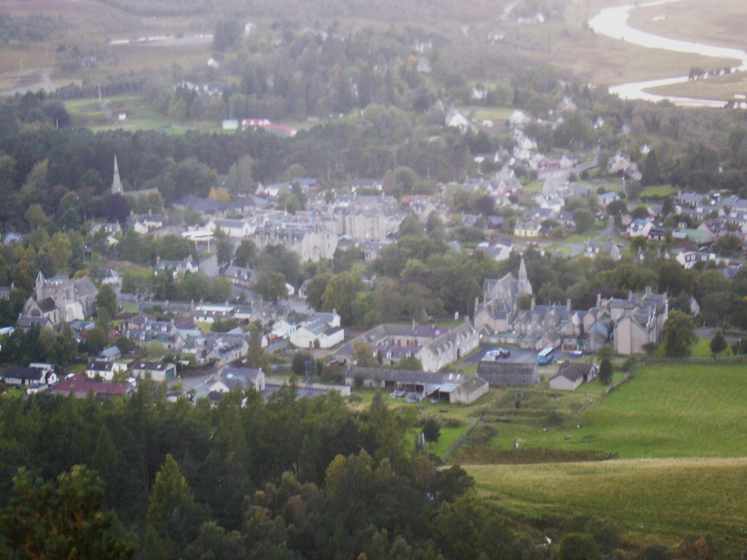
View of Braemar. Not aerial, but high up! |

Alan |
Tuesday 26th of June 2012 08:05:51 PM |
Kindrochit Castle. |
Brian Wilkinson |
Monday 11th of June 2012 02:11:23 PM |