
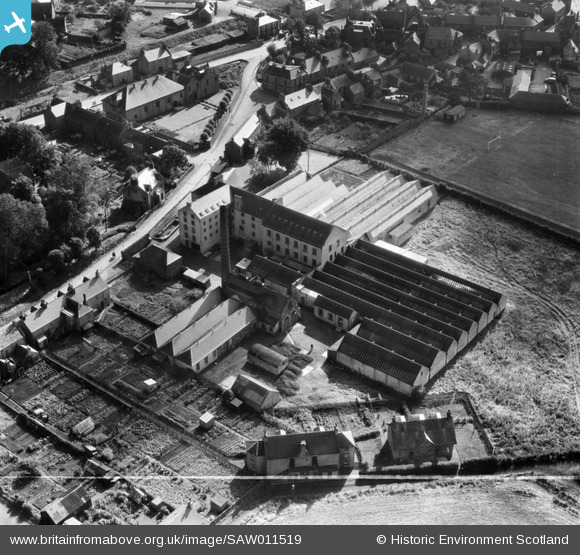
SAW011519 SCOTLAND (1947). Ballantyne's Cashmere Caerlee Mills, Damside, Innerleithen. An oblique aerial photograph taken facing south-east. This image has been produced from a crop marked negative.
© Copyright OpenStreetMap contributors and licensed by the OpenStreetMap Foundation. 2025. Cartography is licensed as CC BY-SA.
Nearby Images (6)
SAW011516

SAW011517

SAW011519

SAW011521

SAW011515

SAW011518

Details
| Title | [SAW011519] Ballantyne's Cashmere Caerlee Mills, Damside, Innerleithen. An oblique aerial photograph taken facing south-east. This image has been produced from a crop marked negative. |
| Reference | SAW011519 |
| Date | 1947 |
| Link | NRHE Collection item 1268742 |
| Place name | |
| Parish | INNERLEITHEN |
| District | TWEEDDALE |
| Country | SCOTLAND |
| Easting / Northing | 333106, 636909 |
| Longitude / Latitude | -3.0623303238287, 55.621160750512 |
| National Grid Reference | NT331369 |
Pins

User Comment Contributions
The Memorial Hall in the background (left). Top right of the photo is the Vale of Leithen Football Club's ground |

Norrie Johnstone |
Monday 27th of August 2012 06:47:55 PM |