
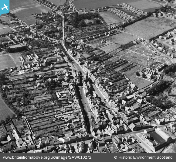
SAW010272 SCOTLAND (1947). Haddington, general view, showing Town House and High Street. An oblique aerial photograph taken facing west.
© Copyright OpenStreetMap contributors and licensed by the OpenStreetMap Foundation. 2026. Cartography is licensed as CC BY-SA.
Nearby Images (4)
SAW010272

SAR018912

SAR018913

SAW010271

Details
| Title | [SAW010272] Haddington, general view, showing Town House and High Street. An oblique aerial photograph taken facing west. |
| Reference | SAW010272 |
| Date | 1947 |
| Link | NRHE Collection item 1268706 |
| Place name | |
| Parish | HADDINGTON |
| District | EAST LOTHIAN |
| Country | SCOTLAND |
| Easting / Northing | 351476, 673895 |
| Longitude / Latitude | -2.7772243254452, 55.95566789974 |
| National Grid Reference | NT515739 |
Pins

John Wass |
Saturday 25th of April 2015 03:42:59 PM |