
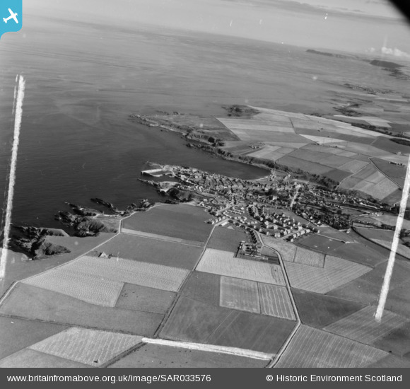
SAR033576 SCOTLAND (1958). General View Fordyce, Banff, Scotland. An oblique aerial photograph taken facing East. This image was marked by AeroPictorial Ltd for photo editing.
© Copyright OpenStreetMap contributors and licensed by the OpenStreetMap Foundation. 2026. Cartography is licensed as CC BY-SA.
Nearby Images (3)
SAR033576

SPW022083

SPW022081

Details
| Title | [SAR033576] General View Fordyce, Banff, Scotland. An oblique aerial photograph taken facing East. This image was marked by AeroPictorial Ltd for photo editing. |
| Reference | SAR033576 |
| Date | 1958 |
| Link | NRHE Collection item 1438646 |
| Place name | |
| Parish | FORDYCE |
| District | BANFF AND BUCHAN |
| Country | SCOTLAND |
| Easting / Northing | 358900, 866050 |
| Longitude / Latitude | -2.6893105451256, 57.682669007789 |
| National Grid Reference | NJ589661 |
Pins

JMB |
Wednesday 15th of April 2015 01:13:37 PM |

