
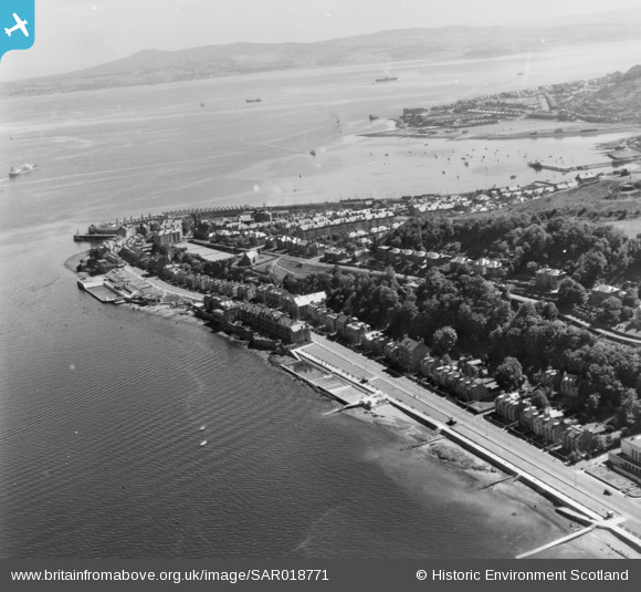
SAR018771 SCOTLAND (1953). Gourock Inverkip, Renfrewshire, Scotland. An oblique aerial photograph taken facing East.
© Copyright OpenStreetMap contributors and licensed by the OpenStreetMap Foundation. 2025. Cartography is licensed as CC BY-SA.
Nearby Images (2)
SAR018771

SPW019604

Details
| Title | [SAR018771] Gourock Inverkip, Renfrewshire, Scotland. An oblique aerial photograph taken facing East. |
| Reference | SAR018771 |
| Date | 1953 |
| Link | NRHE Collection item 1438086 |
| Place name | |
| Parish | INVERKIP |
| District | INVERCLYDE |
| Country | SCOTLAND |
| Easting / Northing | 223920, 677220 |
| Longitude / Latitude | -4.8207252790685, 55.955713855727 |
| National Grid Reference | NS239772 |
Pins

Linbrad |
Friday 11th of August 2017 03:26:47 PM | |
|
Linbrad |
Friday 11th of August 2017 03:25:38 PM | |
|
Linbrad |
Friday 11th of August 2017 03:24:52 PM | |
|
Linbrad |
Friday 11th of August 2017 03:24:13 PM | |
|
Linbrad |
Friday 11th of August 2017 03:23:06 PM |