
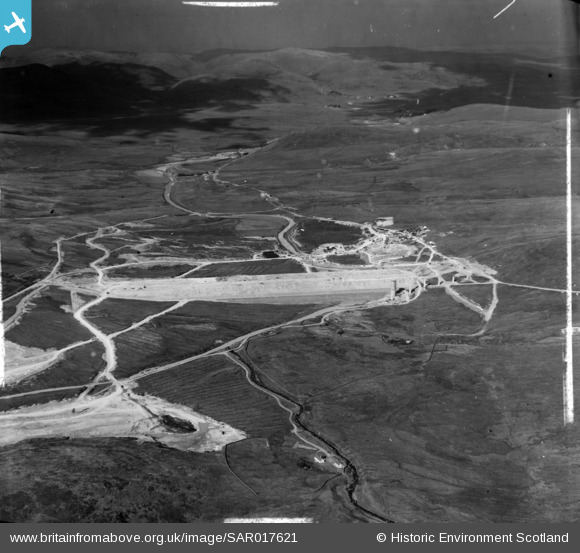
SAR017621 SCOTLAND (1952). Daer Water Scheme, Lanarkshire House Crawford, Lanarkshire, Scotland. An oblique aerial photograph taken facing North/West. This image was marked by AeroPictorial Ltd for photo editing.
© Copyright OpenStreetMap contributors and licensed by the OpenStreetMap Foundation. 2026. Cartography is licensed as CC BY-SA.
Nearby Images (7)
SAR017621

SAR017622

SAR018706

SAR018707

SAR018708

SAR018709

SAR018710

Details
| Title | [SAR017621] Daer Water Scheme, Lanarkshire House Crawford, Lanarkshire, Scotland. An oblique aerial photograph taken facing North/West. This image was marked by AeroPictorial Ltd for photo editing. |
| Reference | SAR017621 |
| Date | 1952 |
| Link | NRHE Collection item 1438017 |
| Place name | |
| Parish | CRAWFORD |
| District | CLYDESDALE |
| Country | SCOTLAND |
| Easting / Northing | 298000, 609200 |
| Longitude / Latitude | -3.6094523386912, 55.366159834284 |
| National Grid Reference | NS980092 |
Pins
Be the first to add a comment to this image!