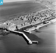
SAR016790 SCOTLAND (1952). Burghead Duffus, Morayshire, Scotland. An oblique aerial photograph taken facing East.

© Copyright OpenStreetMap contributors and licensed by the OpenStreetMap Foundation. 2026. Cartography is licensed as CC BY-SA.
Nearby Images (5)
SAR016789

SAR016790

SAR023865

SAR023866

SAR033423

Details
| Title | [SAR016790] Burghead Duffus, Morayshire, Scotland. An oblique aerial photograph taken facing East. |
| Reference | SAR016790 |
| Date | 1952 |
| Link | NRHE Collection item 1437997 |
| Place name | |
| Parish | DUFFUS |
| District | MORAY |
| Country | SCOTLAND |
| Easting / Northing | 311411, 868947 |
| Longitude / Latitude | -3.4866156121713, 57.701842896534 |
| National Grid Reference | NJ114689 |
Pins

Matt Aldred edob.mattaldred.com |
Sunday 16th of May 2021 09:30:59 PM | |
Its unlikely to be a pillbox. The doorway faces downslope which is were any enemy fire would have come from. It also has very limited field of fire. |

Allan |
Thursday 12th of May 2022 08:21:07 AM |
|
Matt Aldred edob.mattaldred.com |
Sunday 16th of May 2021 09:30:41 PM | |
|
Matt Aldred edob.mattaldred.com |
Friday 5th of March 2021 06:21:05 PM | |
|
Matt Aldred edob.mattaldred.com |
Friday 5th of March 2021 06:20:45 PM | |
|
Matt Aldred edob.mattaldred.com |
Friday 5th of March 2021 06:20:24 PM | |
|
jrussill |
Tuesday 9th of June 2015 01:01:47 PM |